OS1/2/66/5
| List of names as written | Various modes of spelling | Authorities for spelling | Situation | Description remarks |
|---|---|---|---|---|
| DUN CHONNUILL | Dùn Chonnuill Dùn Chonnuill Dùn Chonnuill Dùn Chonnuill Dùn Chonnuill |
Alexander Livingstone Shepherd Garbh Eileach Mr Malcolm Livingston Garbh Eileach Mr Colin Campbell , Teacher Knockrome, Jura Revd [Reverend] D. Graham, Minister of Easdale Johnstons Map of Argyll. |
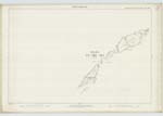
128 | A small island belonging to the parish of Jura situated N.E. [North East] from Garbh Eileach from which it is divided by a sound about 140 yards in breadth. On this island are three somewhat peculiarly shaped mounds (a small one on each end & a large one on the middle) rising precipitously to a height of upwardsd of 300 landed feet, on the tops of two of these - the central & northernmost - are what are said to be ruins of ancient fortification, these ruins, with the exception of one or two instances - have crumbled down to the ordinary surface of the ground. Sig [Signification] Comel's Fort or Castle. |
| SLOC A' CHEATHARNAICH | Sloc a' Cheatharnaich | 128 | A small creek on the east side of "Garbh Eileach," about ⅓ of a mile N.E. [North East] of "Sgeir a' Phuirt," Sig. [Signification] Pit of the hero. |
Continued entries/extra info
[Page] 5[(S]heet 128 Argyll) -- ph [parish] of Jura
[Signature] A. McDonald Lce:CorplR.E. [Lance Corporal Royal Engineers]
Transcribers who have contributed to this page.
Eleanor Brown
Location information for this page.
Linked mapsheets.


