OS1/2/54/4


| List of names as written | Various modes of spelling | Authorities for spelling | Situation | Description remarks |
|---|---|---|---|---|
| BLACK LOCHS | Dubha Lochan Black Lochs Black Lochs |
Donald Colquhoun Lailt William McDonald Lailt Alexander McDonald Bun Lusragan |
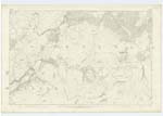
099 | A chain of three lochs, situated about 2 miles south of Kilmaronag. Sig. [Signification] The Black Lochs. |
| KILVAREE | Kilvaree Kilvaree Kilvaree |
Donald Colquhoun William McDonald Alexander McDonald |
099 | A small farm or Croft steading on the west side of the above lochs: the property of Campbell, Lochnell. |
| EILEAN AN T-SAGAIRT | Eilean an t-Saigairt Eilean an t-Saigairt |
Donald Colquhoun Mr. McDonald |
099 | It is very probable, from the prefix Kil, and also from the name Eilean an t-Sagairt or the Priests' Isle, that small island in the loch immediately below Kilvaree, that there has been a church here at some remote date, but nothing is known as to where it stood, or, indeed, anything concerning it. |
Continued entries/extra info
[Page] 4Sheet 99 Muckairn Ph. [Parish] Argyllshire
Black Lochs: The alternative name Loch an Dubha was changed to Dubha Lochan and initialled J.W.
Kilvaree: changed in red pen at a later date to "Kilvarie" with the note: "See the name Kilvarie on Plan 99 25 Inch scale and in Name Book Ph. [Parish] of Muckairn" [Volume 23, Page 27. Situation XCIX-1]
Transcriber's notes
Sorry in advance for the verbiage.As per the note in red ink: "Kilvarie" does appear on Page 27 of Volume 23 and on the 25 Inch scale map 99.1, which is given as the Situation on that page. That location is written in large font [on both 25 & 6inch maps] on a considerable parcel of land alongside the Lusragan Burn: Canmore ID 85257,85258,85259,85260.
The site of "Kilvaree", on the western shore of the Black Lochs, is not covered in the 25" Map 99.1 [referred to in the note], any 25" map of that area has not survived. They are two distinct entities, both appearing on the 6" Sheet 99, the latter written in small type.
Canmore has set of entries for"KIlvaree": ID 23277,23280,8525, describing a farm but also a Standing Stone and a possible Church of St Maelrubha, which fits with the description given further down this page.
"Someone" has come along with a red pen and conflated the two. Prior to this, the Surveyors had the original entry, the Index and Sheet 99 in agreement on "Kilvaree". For these reasons I changed the Prepopulated field.
Transcribers who have contributed to this page.
Zabet- Moderator, Marleyb
Location information for this page.
Linked mapsheets.