OS1/1/27/11


| List of names as written | Various modes of spelling | Authorities for spelling | Situation | Description remarks |
|---|---|---|---|---|
| RIVER DON | Don (The) Don River River Don River River River Don |
Fullarton's Gazetteer of Scotland Johnstone's C [County] Map New Statistical Account Donside Guide Book Mr. Alexander Watt |
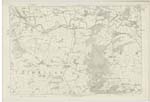
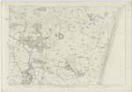
065 ; 066 | "A river of Aberdeenshire. It joins a sort of twin stream to the Dee, and is next to that river in Aberdeenshire as regards at once basin, note, and magnitude, and resembles it also in possessing much volume, and much fine scenery, with very little commercial importance; yet differs essentially from it in some great characters, and even presents some striking contrasts. It rises on the skirts of Ben Avon, 6 miles west of Corgarff, amongst the mountains which bound Aberdeenshire on the south-west, at the head of Strath-Don, and which divide it from the head of Strath-Deveron in Banffshire. Its Source is considerably lower than that of the Dee; the altitude is 1640 feet above sea-level. A great part of its run, though somewhat parallel to the Dee, and at no great distance from it, is through districts much less mountainous, and abounding far more in plains and expanded meadows; so that, instead of the impetuosity and the fitfulness of the Dee, it displays a prevailing current of gentleness, calmness, and regularity. Running eastward in a very sinuous career, through the whole breadth of the county, it flows into the German Ocean on the north side of Aberdeen. Its whole length of course is about 62 miles, though in a direct line from its source to its termination, the distance is only 41 miles. In its earliest stretches through the parish of Strathdon, which it divides into two nearly equal parts, it is joined on both sides by 7 or 8 burns, separated from each other by considerable hills and most of them running through deep hollows, and glens. The principal are the Ernan and the Nochtie. All these burns abound with excellent trout; and salmon is even here very frequently found in the Don, at least towards the lower end of the parish. Turning northward, and dividing for a short distance the parish of Glenbucket from part of Migvie, it receives from the latter the Deshey and from the former the Bucket. Then again flowing eastward, it passes through the parish of Towie; and winding northward, reinforced by other tributaries, round Gorieshill, it all at once becomes remarkably enlarged Westside; after which it resumes its eastern route, dividing various parishes, particularly Forbes and Alford, from the latter of which, on the south, it derives the waters of the Lochel, the most considerable tributary it has yet received. In passing hitherto through the high parts of the district of Alford, the Don flows through a narrow gullet amongst the western mountains, while its banks are now partly wooded. Perpetually changing its course to the north and even the west, to the east and then through Monymusk parish to the south, the next considerable tributary which there enlarges it is the Ton burn from the south; when immediately it turns to the north again between Kemnay and part of Chapel Garioch parishes, and arrives at a point a little to the south of the Royal burgh of Inverury, where, on its northern bank stands the building formerly occupied as the Roman Catholic college of Aquhorties. This point is about 16 miles from the source of the river, and the vicinity contributes, perhaps, the most interesting as well as important part of its whole course. Here, at the Bass, a conical mount of considerable elevation standing in the midst of the confluence, it is joined by its principal tributary, the river Urie, from the district of Strathbogie. The Don, here very much increased by the water of the Urie, not withstanding the previous diversion of a large portion of its waters into the Inverury canal, flows southward from the Bass, between the parish and the lowlands of Kintore on the south, and the mountainous part of Keithall with Kinkell on the north. It divides for a short distance, into two branches, which reunite, enclosing a river - island to the north of the royal burgh of Kintore. Between Fintray and Dyce it is bordered by mountains on both sides, with valuable plantations on the northern or Fintray side. It then turns southward, still dividing the parishes on its line, to Old Machar parish in the freedom of the city of Aberdeen, whence it turns to the east, by the city or old town. In its confluence with the sea, little more than a mile to the northward of the Dee, where it forms a kind of harbour, into which small craft may enter in safety, but where no trade of any importance can be carried on. "About a century ago," says Mr. Kennedy in his 'Annals of Aberdeen', "the channel of the Don near the town was altered, and the stream diverted straight into the sea about a mile further northward than its ancient efflux." In a note he adds, "Probably at some very remote period, Don had continued its former course still further southward down the hollow of the links, till it united with Dee in the harbour, and both together would form one stream into the ocean. Such conjecture is in some measure confirmed by the works of Ptolemy and Richard of Cirencester, there being no such a river as Don delineated in their maps, or even mentioned in their tables, while Diva (Dee) and Ituna (Ythan) in the district of Taixali, are particularly noticed. In the earlier records of the burgh, the river Don is distinguished solely by the name of Aqua Borealis." As this river runs with considerable rapidity during the last 6 miles of its course and as [continued on page 12] |
Continued entries/extra info
[Page] 11Aberdeenshire -- Parish of Dyce
Transcribers who have contributed to this page.
CorrieBuidhe- Moderator, Liz Dow
Location information for this page.