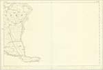
OS1/35/87/73
| List of names as written | Various modes of spelling | Authorities for spelling | Situation | Description remarks |
|---|---|---|---|---|
| CARRICKCARLIN | Carrickcarlin Carrickcarlin |
John Brown Richard Gibson |
036 | [Situation] 9 chains NE by E [North East by East] of Mull of Galloway Light-house A rock used as a seat by fishermen whilst Angling. |
| MULL OF GALLOWAY | Mull of Galloway Mull of Galloway Mull of Galloway Mull of Galloway Mull of Galloway Mull of Galloway Mull of Galloway |
Rev [Reverend] James Lamb William Todd Gazitt. [Gazetter] of Scotland vol [volume] 1 page 602 Statl [Statistical account of Wigtownshire page 201 Rl. Engrs [Royal Engineers] Map 1819 Ainslie's Map 1782 Old Map of Scotland |
036 | [Situation] On the S. [South] Eastern extremity of the Parish of Kirkmaiden A remarkable & well known promontory forming the Southern point of Rhins of Galloway in the Parish of Kirkmaiden, It is an exceedlingly bold rocky headland 1 1/2 miles long and 1/4 of a mile broad, stretching from West to East nearly at right angles with the eastern coast of the mainland, and, connected with the country behind it by a long isthmus the sides of which are indented with small Bays called respectively East & West Tarbet. The South & S.W. [South West] points of the promontory break down almost precipitously into the Sea & are perforated with caverns in which the billows during a Southerly wind & a flowing tide roll and tumultuate with a reverberating sound resembling thunder. - |
Continued entries/extra info
[Page] 73Parish of Kirkmaiden
Form 136
Page 156 - Carrickcarlin
159 - Mull of Galloway
Transcribers who have contributed to this page.
Chr1smac -Moderator, Brenda Pollock
Location information for this page.
Linked mapsheets.


