OS1/35/84/56


| List of names as written | Various modes of spelling | Authorities for spelling | Situation | Description remarks |
|---|---|---|---|---|
| MURLIN STRAND | Muirland Burn Muirland Burn Murlin Strand |
P. McClelland John McCandlish See Name Book 34B |
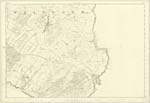
034 | [Situation] Running in a northerly direction & falls into the sea north of Cairnhead (farm house). A small stream on the farm of Cairnhead & flowing into the Bay of Garliestown. (It is a collection of Surface water.) |
| CAIRNHEAD BAY | Cairnhead Bay Cairnhead Bay Cairnhead Bay |
P. McClelland John McCandlish George McHaffie Esqr |
034 | [Situation] About 2 5/8 miles ESE [East South East] of the town of Whithorn. A small Bay in the Bay of Garliestown. It is used by fishermen as a place for landing small boats. |
| CAIRN HEAD | Cairn Head Cairn Head Cairnhead Cairnhead Port Yarrock Head Cairnhead of Portyerrock Cairnhead Cairnhead Cairn Head |
H. D. Stewart Esqr Hugh Stewart P McClelland John McCandlish Sinclairs Statl. Acct. [Statistical Account] George McHaffie Esqr John Broadfoot Provost Alexander McMillan Isaac Connel |
034 | [Situation] About 2 3/4 Miles ESE. [East South East] of town of Whithorn. A low headland projecting into Garlieston Bay near the high water mark on it is a Trigl. [Trigonometrical] Station called by the Trigl [Trigonometrical] party "Cairn head". |
Continued entries/extra info
[Page] 56 -- Parish of WhithornForm 136
Page 156 -- Muirland Burn
154 -- Cairnhead Bay
154 -- Cairnhead
[Note] "Muir land - Gaelic: High seas, High tide"
Transcribers who have contributed to this page.
Chr1smac -Moderator, Larry mag
Location information for this page.
Linked mapsheets.