OS1/35/84/52


| List of names as written | Various modes of spelling | Authorities for spelling | Situation | Description remarks |
|---|---|---|---|---|
| PORTYERROCK MILL (corn) | Portyerrock Mill Portyerrock Mill Poprt Yarrock Mill Portyerrock Mill |
Peter McClelland John McCandlish Ainslies Map 1782 George McHaffie Esqr. |
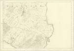
034 | [Situation] Near the E [East] Side of Portyerrock Bridge. And about 2 miles ESE [East South East] of Whithorn. A Corn Mill in good repair on the estate of the Earl of Stair. It has a Kiln, and Other Offices. |
| SHADDOCK POINT | Shaddock Point Shaddock Point Shaddock Point |
Peter McClelland John McCandlish George McHaffie Esqr |
034 | [Situation] About 2 1/8 miles ESE [East South East] of Whithorn. A Rock projection of a ridge like shape running from the high to the low water mark on the N [North] side of Portyerrock Bay & is situated on the Southern extremity of the farm of Shaddock hence the name |
| BOB MUIR | Bob Muir Bob Muir Bob Muir |
Peter McClelland John McCandlish George McHaffie Esqr. |
034 | [Situation] South Side of Shaddock Point and about 2 1/8 miles ESE [East South East] of Whithorn. A large flat rock close by the low water mark on the N [North] Side of Portyerrock Bay which a man named Robert Muir used as a fishing seat hence its name. - |
Continued entries/extra info
[Page] 52 -- Parish of WhithornForm 136
Page 156 -- Portyerrock Mill
151 -- Shaddock Point
151 -- Bob Muir
Transcribers who have contributed to this page.
Chr1smac -Moderator, Larry mag
Location information for this page.
Linked mapsheets.