OS1/35/84/45


| List of names as written | Various modes of spelling | Authorities for spelling | Situation | Description remarks |
|---|---|---|---|---|
| ERSOCK HILL | Ersick Hill Ersick Hill Ersick Hill Ersock Ersock Ersock Hill |
William Stewart William McKelvie John Duff Ainslies Map 1782 Royl. Engrs. [Royal Engineers] Map 1819 George McHaffie Esqr. |
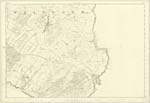
034 | [Situation] About 1 3/8 miles S [South] by W. [West] of the town of Whithorn. A tolerable large hill of arable surface on the farm of Ersick & Drury Lane on it is a Trig : [Trigonometrical] Station called by Trig: [Trigonometrical] Party "Pheasgill" the road from Whithorn to Physgill passes over its Summit. |
Continued entries/extra info
[Page] 45 -- Parish of WhithornForm 136
Page 137 -- Ersick Hill
Transcribers who have contributed to this page.
Chr1smac -Moderator, Larry mag
Location information for this page.
Linked mapsheets.