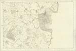
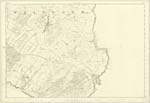
OS1/35/84/27
| List of names as written | Various modes of spelling | Authorities for spelling | Situation | Description remarks |
|---|---|---|---|---|
| SHERIFF'S LAND | Sherriff's Land Sheriff's Land Sheriff' Land |
Robert Dunsmore William Blain George McHaffie Esqr |
030 | [Situation] About 1 1/4 miles E [East] by N [North] of the town of Whithorn. A large tract of good cultivated land comprising the farms of Cults. Brownhill Cruggleton Baltier , Kevand & Palmallet in the Parish of Sorbie & Aulbrick in the Parish of Whithorn it is the property of Sir A. Agnew Bart [Baronet] of Lochnaw. It is said that this land was granted to the Sheriff of Wigtownshire by one of the Kings of Scotland it is still known in the locality by the given name |
| PORT ALLAN | Port Allen Port Allen Port Allan Port Allan Port Allan |
John Gilmour William Blain Ainslies Map 1782 Rl Engrs [Royal Engineers] Map 1819 George McHaffie Esqr |
034 | [Situation] About 2 miles ENE [East North East] of Whithorn. A small bay situated about half a mile eastward of the farm of Dinnance where in former times Smuggled goods were landed |
Continued entries/extra info
[Page] 27 -- Parish of WhithornForm No 136
Page 107 -- Sheriff's Land
109 -- Port Allan
Transcriber's notes
Sheriff's land is on OS Map 030Transcribers who have contributed to this page.
Chr1smac -Moderator, Larry mag
Location information for this page.


