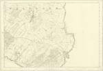
OS1/35/84/24
| List of names as written | Various modes of spelling | Authorities for spelling | Situation | Description remarks |
|---|---|---|---|---|
| DRUMMASTON HILL | Drummaston Hill Drummaston Hill Drummaston Drummaston hill |
John McConnell Alexander Morrison Royl Engs [Royal Engineers] Map 1819 George McHaffie Esqr |
034 | [Situation] About 7/8 mile ENE [East North East] of the town of Whithorn. A Considerable arable hill upon the farm of Drummaston on its Summit stands a Trig: [Trigonometrical] Station called by Trig : [Trigonometrical] party "Drumostin" |
| DRUMMASTON | Drummaston Drummaston Drumnaston Drummaston Drummaston |
John McConnell Alexander Morrison Ainslies Map 1789 Rl Engrs [Royal Engineers] Map 1819 George McHaffie Esqr |
034 | [Situation] About 7/8 mile E [East] by N [North] of thew town of Whithorn. A neat farm house & Offices in good repair with 139 Acres of land attached on the estate of S.H. Stewart Esq of Physgill & glasserton |
| SOUR HILL | Sour Hill Sour Hill Sour Hill |
John McConnell Alexander Morrison George McHaffie Esqr |
034 | [Situation] About 3/8 mile ENE [East North East] of Whithorn. A small arable hill upon the farm of Common Park |
Continued entries/extra info
[Page] 24 -- Parish of WhithornForm 136
Page 105 -- Drummaston Hill
106 -- Drummaston
105 -- Sour Hill
[Note] "Sour-land" - land which when left
untilled either becomes Swardless
from too much moisture or produces
nothing but Sedgegrasses or other worthless
or aquatic plants. Jamiesons Scottish Dictionary
Transcribers who have contributed to this page.
Chr1smac -Moderator, Larry mag
Location information for this page.
Linked mapsheets.


