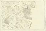
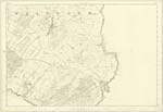
OS1/35/84/21
| List of names as written | Various modes of spelling | Authorities for spelling | Situation | Description remarks |
|---|---|---|---|---|
| CHALLOCH HILL | Challoch Hill Challochn hill Challoch hill |
John McConnell John Dinnel George McHaffie Esqr |
034; 030 | [Situation] One mile NN W[North North west] of Whithorn. A small arable hill upon the lands of Bidshoptom |
| STIRNIE PEN | Sternie Pen Sternie Pen Sternie Pen Stirnie Pen Stirnie Pen Stirnie Pen |
Revd. [Reverend] C. Nicholson William Coid George McHaffie Esqr John Broadfoot John Blain James Clark |
034 | [Situation] About 1/2 mile NNW [North North West] of the town of Whithorn. A tolerable large pen or Culvert on the Road from Whithorn to Wigtown of about one mile from the former place. it is supportedf by the county. |
| STIRNIE BIRNIE BURN | Sternie Burn Sternie Burn Sternie Burn Stirnie Birnie Burn Stirnie Birnie Burn Stirnie Birnie Burn |
Revd. [Reverend] C. Nicholson William Coid George McHaffie Esqr John Broadfoot Provost John Blain Baillie James Clark |
034 | [Situation] Running in a S [South] Easterly direction from Challoch Hill passing S [South] of Hill Head & E [East] Side of Sour Hill to ClayWhippart Bridge. A stream of Surface water collecting on the lands of Bishopton and running in an easterly direction crossing the road from Whithorn to Wigtown of Garliestoun & joins the River Kett at Claywhippart Bridge. - |
Continued entries/extra info
[Page] 21 -- Parish of WhithornForm 136
Page 97 -- Challoch Hill
99 -- Stirnie Pen
99 -- Stirnie Burn
Stair na Bir [Gaelic] The stepping
Stones of the River or Water etc
Transcribers who have contributed to this page.
Chr1smac -Moderator, Larry mag
Location information for this page.


