OS1/35/77/38


| List of names as written | Various modes of spelling | Authorities for spelling | Situation | Description remarks |
|---|---|---|---|---|
| REIFER PARK | Riffer Park Reeferpark Reeferpark Rifferpark Rifer Park Riffer-park Reifer Park |
Andrew Broadfoot John Broadfoot Alexander Douglas W. Dorman Ainslie's Map 1782 Royl. Engrs. [Royal Engineers] Map 1819. George McHaffie Esqr. |
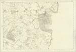
030 | [Situation] 1 mile S.E. [South East] by South from Sorbie Village. A farm house with extensive Offices in good repair and a farm of land containing 250 acres on the estate of Horatio Stewart Murray Esquire of Broughton. |
| BLOODY NOOK | Bloody Nook Bloody Nook Bloody Nook Bloody Nook |
John Broadfoot A. Broadfoot W. Dorman George McHaffie Esqr. |
030 | [Situation] 1 1/8 miles S.E. [South East] from Sorbie Village. This name applies to the [junction] of fences on the road leading from Sorbie to the public road from Garliestown to Whithorn contiguous to Reeferpark. The tradition of the locality is that the battle of Cairnholly being fought that Thomas, then Bishop of Whithorn encamped here when on their march from Kirkcudbright to Whithorn & assisted in the said Battle of Cairnholly. There is a Camp lies a little South of this place. Mr. Broadfoot called it a British Camp. |
Continued entries/extra info
[Page] 38 -- Parish of WhithornForm 136
Page 75 - Reifer Park
Transcribers who have contributed to this page.
Chr1smac -Moderator, Muriel Rousay
Location information for this page.
Linked mapsheets.