OS1/35/77/19


| List of names as written | Various modes of spelling | Authorities for spelling | Situation | Description remarks |
|---|---|---|---|---|
| CULNOAG HILL | Culnoag Hill Culnoag Hill Culnoag Hill Kilnog Culnoag Culnoag Hill |
William Douglas Alexander McKie W. Dorman Ainslie's Map 1782 Royl. Engrs. [Royal Engineers] Map 1819. George McHaffie Esqr. |
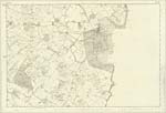
030 | [Situation]1 mile W.N.W. [West North West] from Sorbie Village. A Small arable hill upon the farm of Culnoag and estate of the Earl of Stair, upon its Summit stands a Trig. [Trigonometrical] Station called by Trig: [Trigonometrical] Party 'Culnoag'. |
| CULNOAG | Culnoag Culnoag Culnoag Kilnog Culnoag Culnoag |
William Douglas Alexander McKie W. Dorman Ainslie's Map 1782 Royl. Engrs. [Royal Engineers ]Map 1819 George McHaffie Esqr. See also Name List Plan 29B. |
030 | [Situation] 1 mile W. by N. [West by North] from Sorbie Village. A farm house and Offices in tolerable repair together with about 200 acres of land on the estate of the Earl of Stair. |
| WELL CROFT | Well croft Well Croft Well Croft Well Croft |
William Douglas Alexander McKie W. Dorman George McHaffie Esqr. |
030 | [Situation] 7/8 mile W. by S. [West by South] from Sorbie Village. A dwelling house with about 15 acres of land attached on the estate of the Earl of Stair. |
Continued entries/extra info
[Page] -- Parish of SorbieForm 136
Page 49; 60 - Culnoag Hill
60- Culnoag [Note] (Cuil nochd) A bare unsheltered corner N.W. [North West] pronounced nochK
61- Well Croft
Transcribers who have contributed to this page.
Chr1smac -Moderator, Muriel Rousay
Location information for this page.
Linked mapsheets.