OS1/35/73/35


| List of names as written | Various modes of spelling | Authorities for spelling | Situation | Description remarks |
|---|---|---|---|---|
| BLAIRSHINNOCH | Blairshinnoch Blairshinnoch Blairshanach Blairshennoch Blairshinnoch |
William Heron Alexander McCulloch Ainslie's Map of 1782. Rl Engrs. [Royal Engineers] Map 1819. George McHaffie, Esqr. |
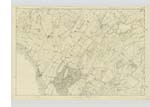
029 | [Situation] 1 1/4 mile E by N [East by North] of Kirk of Mochrum. A neat a commodious farm house one Story high and out houses including a thrashing machine (of horse power), all Slated and in good repair, with a considerable farm of arable land attached. Occupied by Mrs Jardine. The property of Sir William Maxwell. |
| BLAIRSHINNOCH HILL | Blairshinnoch Hill Blairshinnoch Hill Blairshinnoch Hill |
William Heron John McDowall George McHaffie Esqr. |
029 | [Situation]1 3/8 miles E by N [East by North] of Kirk of Mochrum. A hill on the farm of Blairshinnoch, the soil of which is arable land, on it is a Trigl [Trigonometrical] Station called by Trigl. [Trigonometrical] Party 'Barshanagh'. |
| BLAIRSHINNOCH BRIDGE | Back Bridge Back Bridge Blairshinnoch Bridge |
William Heron. John McDowall George McHaffie Esq. |
029 | [Situation] About 1 3/8 miles E by N [East by North] of Kirk of Mochrum. A double Peir built with Stone on the road from Mochrum Kirk to Wigtown & on the farm of Blairishinnoch. It is sometimes called Back Bridge to distinguish it from Glentriplock Bridge. - |
Continued entries/extra info
1st Page of Trace 7 29 A -- Parish of Kirkinner -- [Page] 35Form 136
Page - 75- Blairshinnoch - Blar Sionnaich The fox field or field abounding in foxes
- 75- Blairshinnoch Hill
- 78 - Back bridge [Note ] " Is it a County Br. [Bridge] "
Transcribers who have contributed to this page.
Chr1smac -Moderator, Muriel Rousay
Location information for this page.
Linked mapsheets.