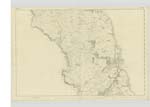
OS1/35/71/9


| List of names as written | Various modes of spelling | Authorities for spelling | Situation | Description remarks |
|---|---|---|---|---|
| ARDWELL BAY | Ardwell Bay Ardwell Bay Ardwell Bay |
Thomas Kerr Andrew McDowall Ainslies Map 1789 |
027 | [Situation] A Creek or inlet of the sea on the western shore of Stoneykirk which affords a good landing place for Vessels the only inconvenience it has is the want of a small Quay or Wharf this Bay is interspersed with Gravel & Sand free of rocks. on the North and South of it, is very rocky & precipitous. |
| HORNEY | Horny Horney Horney Horney |
Alexander McColm Andrew McDonald See Name List Plan 27A page 25 Rl. Engs. [Royal Engineers] Map 1819 |
027 | [Situation] 3/8 Mile NW [North West] of High Ardwell. A projecting piece of land rugged in appearance the West side is a sloping declivity - situate East of Stinking Bight. |
| STINKING BIGHT | Stinking Bight Stinking Bight Stinking Bight Stinking Bught Stinking Bught Stinking Bught Stinking Bight |
Andrew McDoanld Peter Crawford Revd, [Reverend] John Lamb Alexander McColm David Adams John McMillan High Ardwell William Todd Drumore |
027 | [Situation] ½ Mile West of High Ardwell This name applies to a small portion of sea shore between rocks where sea weed is driven in by the tide, when left for any time it has a disagreeable smell hence the name |
Continued entries/extra info
[Page] 9Parish of StoneyKirk
Bight - The inclination of a Bay etc. Dr Jamieson
Transcribers who have contributed to this page.
DANIALSAN
Location information for this page.
Linked mapsheets.