OS1/35/71/23


| List of names as written | Various modes of spelling | Authorities for spelling | Situation | Description remarks |
|---|---|---|---|---|
| DRUMANTRAE PLANTATION | Drumantrae Planting Drumantrae Planting Drumantrae |
Sir John McTaggart Hugh Henry Ainslies Map 1782 |
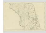
027 | [Situation] ½ mile N.E. of Ardwell House A long narrow stripe of plantation on the farm of Drumantrae the wood of which consists of Ash Oak and Fir, with some beech. The property of Sir John McTaggart |
| ISLES OF KILLASER | The Isles of Killeser The Isles of Killeser Killaser Isles of Killaser |
Sir John McTaggart Hugh Henry Simsons description of Galloway page 65 Pel. 1823 Ainslies Map 1782 |
027 | [Situation] ½ Mile East of Ardwell House A considerable Strand or bay on the sea shore of the lands of Ardwell Sir John McTaggart says this place had been a harbour formerly where vessels of any Tonage might enter. Nothing remains of it now except a few bare stakes of wood & two elevations which marks the place that once were Islands or landing places they are now washed over by the tide. There is safe anchorage a short distance from land. |
Continued entries/extra info
[Page] 23Parish of Stoneykirk
Druim (Gaelic) The ridge of a hill etc.
Traigh (Gaelic) The sea shore etc.
Transcribers who have contributed to this page.
DANIALSAN
Location information for this page.
Linked mapsheets.