OS1/35/71/12


| List of names as written | Various modes of spelling | Authorities for spelling | Situation | Description remarks |
|---|---|---|---|---|
| KILLASER BURN | Killeser Burn Killeser Burn Killeser Burn . . . Killaser Burn . . Killaser Killaser |
John Ferguson George McGill Alexander McMillan Blk. Smith [Blacksmith] Ardwell Inn Symsons description of Galloway page 65 Ainslies Map 1782 Royal Engineers Map |
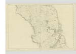
027 | [Situation] West and South of Ardwell House A small stream or Burn taking its rise in the moss of Knockcairnn[--] and running in a S. [South] Easterly direction forming the boundary between several farms to its influx with Luce Bay near Ardwell Inn |
| TAYLORS HILL | Taylors Hill Taylors Hill |
George McGill John Burch |
027 | [Situation] 1 Mile West of Ardwell House A low hill of a ridge like shape on the farm of Low Ardwell the Soil of which is arable land |
| TOR HILL | Torr Hill Torr Hill |
George McGill John Burch |
027 | [Situation] 7/8 Mile West of Ardwell Hill A high hill on the farm of Cairnhandie the soil of which is good arable land on the North East side of this hill is a plantation called Torr Planting. |
Continued entries/extra info
[Page] 12Form 136
Page 63- Killaser Burn
57/ 64 - Taylor's Hill
64- Tor Hill
Parish of Stoneykirk
Hills of this description through England are invariably Spelt 'Tor'
and on Plan 9B Wigtownshire we have 'Tor of Craigach' Although the Gaelic mode
of spelling Hills of this description is Torr according to Macleod's Gaelic Dictionary
yet it is seldom that the English and Gaelic correspond.
Torr Hill
Listed on Plan
See N. [Name] Books 12 A
17 C
23 A pages 3.4.5.6
Transcribers who have contributed to this page.
Chr1smac -Moderator, DANIALSAN
Location information for this page.
Linked mapsheets.