OS1/35/69/7


| List of names as written | Various modes of spelling | Authorities for spelling | Situation | Description remarks |
|---|---|---|---|---|
| SKELLARIE ROCK | Scellery Rock Scellery Rock . Scellery Rock Skellarie Rock |
John Cowan George Greenshields John McGuffie George McHaffie Esqr. |
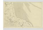
026 | [Situation] 1/2 mile NE [North East] of South Balfern. This name applies to a flat point of the seacoast consisting of Stratified rocks and is nearly covered at Spring tides. It is on the farm of Balfern. The property of the Earl of Galloway. At this place is a Trigl. [Trigonometrical] Station called 'Balfern Point' by trigl. [trigonometrical] Party. |
| ORCHARDTON BAY | Orchardton Bay Orchardton Bay Orchardton Bay . Orchardton Bay . Orchardtown Bay . Orchyardtown Bay |
Robert Young John Cowan George Greenshields George McHaffie Esqr. Royl Engrs. [Royal Engineers] Map 1819 Ainslies Map 1820 |
026 | [Situation] On the West side of Wigtown Bay and East of South Balfern. This name applies to a part of the Shore & coast SE [South East] off Scellery Rock forming a Sort of bay or Creek where small vessels formerly put in with coal etc., very seldom vessels anchor here at present. |
| LADY BURN | Lady Burn Lady Burn Lady Burn |
Robert Young John Cowan George McHaffie Esqr |
026 | [Situation] East of South Balfern. A considerable Stream or burn which rises in the farm of South Balfern & runs a considerable distance through the Baldoon Sands to the Sea. A traditional Story is told concerning two young women drowning themselves in the Stream which it is Said gave rise to the name. - |
Continued entries/extra info
[Page] 7 -- Parish of KirkinnerForm 136
page -- Scellery rock
29 -- Orchardton Bay
27 -- Lady Burn
Transcribers who have contributed to this page.
Chr1smac -Moderator, Muriel Rousay
Location information for this page.
Linked mapsheets.