OS1/35/69/4


| List of names as written | Various modes of spelling | Authorities for spelling | Situation | Description remarks |
|---|---|---|---|---|
| BYNG HILL | Byng Hill Byng Hill Byng Hill Byng Hill |
Mr. John Cowan Mr. James McLauchlin Mr. John McGuffie George McHaffie Esqr. |
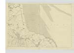
026 | [Situation] 3/8 mile WNW [West North West] of Knochencurr. A large hill of arable Land on the summit of which is a Trigl. [Trigonometrical] Station. It commands a view of the Isle of Man and of the Hills of Cumberland, and it is the property of R.V. Agnew. |
| KNOCKEFFERICK HILL | Knockefferick Hill Knockeffrick Hill Knockeffrick Hill . Knockefferick Knockaffrick. . Knockefferick Hill |
John Cowan John McGuffie Royal Engineers Map 1819. Ainslies Map 1870 George McHaffie, Esqr. See Plan 25D. |
026 | [Situation] 1/2 mile WSW [West South West] of Knockencurr. A small hill the Surface of which is arable, Situate about a mile South off Byng Hill, on the Summit is a Trigl. [Trigonometrical] Station. |
| AIRIES HILL | Airies Hill Airies Hill Airies Hill Airies Hill |
John Cowan John McKie John McGuffie George McHaffie, Esqr. |
026 | [Situation] 1 Mile SW by S [South West by South] of Knockencurr A moderate Sized hill on the [farm] of Little Airies, the base is nearly [circular], the Soil is arable, on its Summit is a Trigl. [Trigonometrical] Station |
Continued entries/extra info
[Page] 4 -- Parish of KirkinnerForm 136
Page 17 - Byng Hill
17 - Knockeffrick Hill
19- Airies Hill
[Note] Little Airies Hill
adopted to agree with Plan
29B - 30A - 25B
Transcribers who have contributed to this page.
Chr1smac -Moderator, Muriel Rousay
Location information for this page.
Linked mapsheets.