OS1/35/67/3


| List of names as written | Various modes of spelling | Authorities for spelling | Situation | Description remarks |
|---|---|---|---|---|
| CROOK | Crook Crook Crook Cruik |
Mr. J. Muir Mr. J. Broadfoot G. McHaffie Esq. Rl. Engrs [Royal Engineers ] Map 1819. |
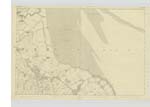
026 | [Situation] At the East end of Hills Road adjoining the Sea Coast & 1 3/4 Miles N E [North East] of Kirkinner A Cottage house built of Stone & outbuildings attached, & an existing farm of good land, property of the Earl of Galloway in the occupation of Mr. J. Muir - |
| CROOK PLANTATION | Crook Planting Crook Planting Crook Plantation | Mr. J. Muir Mr. J. Broadfoot G. McHaffie Esqr. |
026 | [Situation] 3/4 mile East of East mains Commencing at Lane Burn's extending Southwards, crossing "Shell Road", continuing Southwards for about 10 Chains when it joins "Galowhae Plantation" A narrow Ridge of mixed Trees or Plantation on the Crook farm. |
| GALLOWHAE PLANTATION | Gallowhae Plantation Gallowhae Planting |
G. McHafiie Esqr, Mr. J. Broadfoot |
026 | [Situation] Joining "Crook Planting" at 10 chains South of "Shell Road", extending Southwards for nearly 3/4 of a mile , & joins "Skellaries Plantation A narrow Ridge of mixed Trees or Plantation on the "Crook farm. |
Continued entries/extra info
[Page] 3 -- Parish of KirkinnerForm 136 Page 18 - Crook
18- Crook Plantation
19- Gallowhae Plantation
Transcribers who have contributed to this page.
Chr1smac -Moderator, joseph mc keown
Location information for this page.
Linked mapsheets.