OS1/35/66/3


| List of names as written | Various modes of spelling | Authorities for spelling | Situation | Description remarks |
|---|---|---|---|---|
| TINTOCK HILL | Tintock Hill Tintock Hill Tintock Tintock Hill |
John Cowan W. McWhinny Ainslie's map 1782 George McHaffie Esqr. |
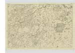
025 | [Situation] 1 3/8 Mile NW [North West] of Kildarroch A Small hill of Considerable elevation, the soil of which is arable but rocky. Situate in the farm of Airles. The property of W. Adamson Dumfries. On the Summit of this hill is a Trigl. [Trigonometrical] Station called "Tintock Hill" by Trigl. [Trigonometrical] Party.- |
| KILDARROCH MOOR | Kildarroch Moor Kildarroch Moor Kildarroch Moor Kilderrach Kildarroch Kildarroch Moor |
J. Cowan James McMaster William Hartley Ainslies Map 1782. Royal Engineers Map. George McHaffie Esq. |
025 | [Situation] 3/8 mile West of Kildarroch. A large tract of rough ground including a portion of moss. All divided into Several Small holdings for the purpose of reclaiming it. It is part of the estate of Kildarroch, the property of John McMaster. |
| CRAIGDARROCH | Craigdarroch. Craigdarroch. Craigdarroch. |
James McMaster William Hartly George McHaffie Esq. |
025 | [Situation] 1/2 mile NW [North West] of Kildarroch. A Small hill or hillock the base of which is of an oval Shape, the Surface is a Heathy pasture. It is part of Kildarroch Moor. |
Continued entries/extra info
Parish of Kirkinner -- Page] 3Form 136
Page 25 - Tintock Hill
31 - Kildarroch Moor
29 - Craigdarroch
Transcribers who have contributed to this page.
Chr1smac -Moderator, Muriel Rousay
Location information for this page.
Linked mapsheets.