OS1/35/65/7


| List of names as written | Various modes of spelling | Authorities for spelling | Situation | Description remarks |
|---|---|---|---|---|
| UPPER GLENLING | High Glenling High Glenling Upper Glenling Upper Glenling Upper Glenling |
James Liveston. Hugh Flyn. Map of property 1790. Ainslies Map 1782. George McHaffie, Esq. |
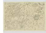
025 | [Situation] 1 1/4 miles N N W [North North West] of Eldrig Loch. A small farm house and out houses all in good repair with a considerable farm of land, attached, occupied by James Liveston, the property of the Marquis of Bute. On this farm is a Trigl [Trigonometrical] Station called by Trigl. [Trigonometrical] Party 'Glenlung. The rock on which it is situated is not Known by any particular name. |
| GLENLING BURN | Glenling Burn Glenling Burn Glenling Burn |
David McNoah. Hugh Flyn. George McHaffie, Esq. |
025 | [Situation] 1 1/8 mile N N W [North North West] of Eldrig Loch. A considerable stream or burn taKing its rise in the farm of Arieleck and running in an Easterly direction to its influx with water of the Malzie. It forms a portion of the boundary between the farms of Glenling and Derry. |
Continued entries/extra info
[Page] 7 --Plan 5C -- Parish of MochrumForm 136
page 29 High Glenling
31 Glenling Burn
[Note] Gleann-linne - The valley of the pond or pool, etc.
Transcribers who have contributed to this page.
Chr1smac -Moderator, Muriel Rousay
Location information for this page.
Linked mapsheets.