OS1/35/65/24


| List of names as written | Various modes of spelling | Authorities for spelling | Situation | Description remarks |
|---|---|---|---|---|
| DRUMNESCAT | Drumnesket Drumnesket Drumnescat Drumnescat |
William Livingston Andrew Anderson Royl Engrs. [Royal Engineers ] Map 1819. George McHaffie, Esqr. |
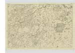
025 | [Situation] 1 mile ENE [East North East] of Eldrig Loch. A small farm house and out houses all in middling repair with a farm of land attached, the great portion of which is arable land. Occupied by William Livingston. The property of Sir William Maxwell. |
| SHAW HILL | Shaw Hill Shaw Hill Shaw Hill |
William Livingston Andrew Anderson George McHaffie Esqr. |
025 | [Situation] 1 1/4 miles ENE [East North East] of Eldrig Loch. A considerable hill on the farm of Drumnesket the Soil of which is chiefly arable land. On it is a Trigl. [Trigonometrical] Station called by Trigl. [Trigonometrical] Party 'Shaw Hill'. |
Continued entries/extra info
[Page] 24 -- Parish of MochrumForm 136
Page 49- DrumnesKet
50- Shaw Hill
Drum- Naosgach - A ridge or hill
abounding in Snipes.
Shaw - A piece of ground which becomes suddenly flat
at the bottom of a hill or Steep bank.
Transcribers who have contributed to this page.
Chr1smac -Moderator, Muriel Rousay
Location information for this page.
Linked mapsheets.