OS1/35/64/39


| List of names as written | Various modes of spelling | Authorities for spelling | Situation | Description remarks |
|---|---|---|---|---|
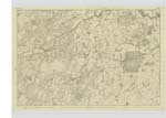
| RIVER BLADENOCH | River Bladenoch River Bladenoch Bladenoch Water Bladenoch Water River Bladenoch |
George McHaffie Esqr. Alexander McClelland Ainslies Map 1782 Royal Engineers Map 1819 Geo McHaffie Esqr. |
025 | [Situation] Running in Southerly direction from Loch Maberry on the boundary of Ayrshire & passing through the NE [North East] portion of Wigtownshire, falls into Wigtown Bay near the town of Wigtown. A Considerable river dividing the Parish of Kirkinner from Wigtown and running in a SW [South West] direction untill it discharges itself into the Sea at Wigtown Bay and is navigable as far as Bladenoch Bridge. |
| COTLAND HILL | Cotland Hill Cotland Hill Quiotland Hill Cotland Hill |
Dr. [Doctor] Thomas McMillan Alexander McKenna Thomas McMullen Esqr. George McHaffie Esqr. |
025 | [Situation] About 3/8 mile WNW [West North West] of Bladenoch Distillery. An arable hill upon the farm of Cotland and estate of the Earl of Galloway. |
| COTLAND PLANTATION | Cotland Plantating Cotland Plantating Quoitland Plantation Cotland Plantation |
Dr. [Doctor] Thomas McMillan James Black Thomas McMullen Esqr. George McHaffie Esqr. |
025 | [Situation] About 1/2 mile west of Bladenoch Distillery. A tolerable large portion of Wood on the farm of Cotland consisting of mixed wood and on the North West side of the River Bladenoch. |
Continued entries/extra info
[Page] 39 -- Parish of WigtownForm 136
Page 65; 67 -- River Bladenoch
61 ; 69 -- Cotland Hill
61 ; 70 -- Cotland Plantation
Transcribers who have contributed to this page.
Chr1smac -Moderator, Muriel Rousay
Location information for this page.
Linked mapsheets.