OS1/35/58/8


| List of names as written | Various modes of spelling | Authorities for spelling | Situation | Description remarks |
|---|---|---|---|---|
| PILTANTON BURN | Pooltanton Burn Piltanton Burn Piltanton Burn Piltanton Burn Pooltanton P67 * Plitanton p83 Pooltanton p125 Pilltanton , p237 Pooltanton p 237 |
William Thorburn Johnsons Map of Wigtownshire Ainslie's map 1782 George McHaffie Esqr. * Statistical account 1841 |
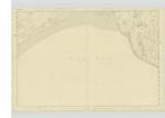
023 | [Situation ] - On the Western side of Wigtonshire near its source passing close to S.W. [South West] - A river or large burn which [rises] in the Parish of Leswalt running in a Easterly [direction] passing by the Parishes of Portpatrick, Inch, & Stoneykirk forming in part the boundary between those Parishes & passes through the S. [South] Western part of Old Luce Parish, It falls into the Bay of Luce at Burnfoot |
| ST HELENA ISLAND | St. helena Island St. Helena St. Helena Island |
John Dole Revd [Reverend] J Puller George McHaffie Esqr. |
023 | [Situation]- In Sth [South] Side of the Ph. [Parish] of Old Luce at the junction of the River Luce with the Bay of Luce - An island formed on one side by the old course of the river Luce & on the other by the new course which has been cut some years ago in [order ] to improve the fishery of this[ place] Since the latter circumstance [took] place it has become an Island form which time the fishermen being at a loss for a name called it (St. Helena) |
Continued entries/extra info
[Page] 8 -Parish of Old LuceForm 136
Page
16 - Pooltanton Burn
16- St. Helena Island
Transcribers who have contributed to this page.
Chr1smac -Moderator
Location information for this page.
Linked mapsheets.