OS1/35/58/10


| List of names as written | Various modes of spelling | Authorities for spelling | Situation | Description remarks |
|---|---|---|---|---|
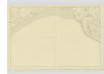
| LUCE BAY | Luce Bay Luce Bay Luce Bay |
James Torburn Ainslie's Map 1782 Statistical Acct [Account] 1841 |
023 | [Situation] - At the South Side of Wigtonshire - A large Bay comprehending an area of 400 square miles extending from the mull of Galloway to Burrows- head in Whithorn the coast in some part is sandy in others gravelly & some clayey also in part very bold and rocky within about two miles of Glenluce. A quay has been built in 1845 which affords good accomodation for landing goods etc. It is situate south of the old place of landing called Burnsfoot. The imports here are lime, coal etc. The rental of this fishery is £70or £80. Shell- fish of various kinds, flounders, and codfish, are also taken within the bay of Luce |
Continued entries/extra info
[Page] 10 -- Parish of Old LuceForm 136
Page 13 - - Luce Bay
[Note ] * This was the Abbravanus Sinus of Ptolemy " " Chalmers Caledonia"
Transcribers who have contributed to this page.
Chr1smac -Moderator
Location information for this page.
Linked mapsheets.