OS1/35/44/4


| List of names as written | Various modes of spelling | Authorities for spelling | Situation | Description remarks |
|---|---|---|---|---|
| MUIL HILL | Mull Hill Mull Hill Muil Hill Muil Mule |
John Aderson Nathaniel Boyd G. McHaffie Esqr Royl Engrs [Royal Engineers] Map Ainslies Map |
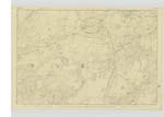
018 | [Situation] 1 1/8 miles West of Craighlaw. A Small arable hill upon the farm of Mull from which it takes its name. |
| NEAR BARBUNNY | Near Barbonnie Near Barbonnie Near Barbunny |
John Anderson Nathaniel Boyd G. McHaffie Esqr. |
018 | [Situation] 7/8 mile west of Craighlaw.- A Small hill upon the farm of Mull consisting of arable & Rocky heathy pasture. |
| BARMORE | Barmore Barmore Barmore Barmore |
John Anderson Nathaniel Boyd Ainslies map 1782 George McHaffie Esqr. |
018 | [Situation] 1 1/2 miles W, by S [West by South] Craighlaw. A small hill upon the farm of Barmore consisting of arable & Rocky heathy pasture on its Summit stands a Trig [Trigonometrical] station called by Trig [Trigonometrical] party Barmore. |
| BARMORE MOSS | Barmore Moss | See Name List Plan 18A |
[Situation] At the south side of Barmore (Hill) For description see Name List for Plan 18A |
Continued entries/extra info
[Page] 4Parish of Kirkcowan
Form 136 Page
40 -- Muil Hill
41 -- Near Barbunny
39 -- Barmore
Transcribers who have contributed to this page.
Chr1smac -Moderator, Moira L- Moderator, HamiltonMurdoch
Location information for this page.
Linked mapsheets.