OS1/35/41/12


| List of names as written | Various modes of spelling | Authorities for spelling | Situation | Description remarks |
|---|---|---|---|---|
| CLENDRIE HILL | Clendrie Hill Clendrie Hill Clendrie Hill |
Sir J. D. Hay John McIwrick George McHaffie Esqr. |
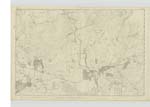
017 | [Situation] About 4 1/2 mile N. W [North West] of Glenluce 1 mile N. W [North West] of Dunragit. A rough and rocky hill [on] the farm of Lower [Clendrie] on its summit stands a trigl [trigonometrical] station named by the trigl. [trigonometrical party] Old Hall. |
| DROUGHDOOL BRIDGE | Droughdool Bridge | William Linwood James Kerr James Alexander |
017 | [Situation] 1 Mile South of Dunragit. A small Stone Bridge of one Arch, on the Road from Portpatrick to Glenluce This is a County Bridge |
| WHITECROOK BRIDGE | Guthries Bridge Guthries Bridge Guthries Bridge Guthries Bridge Whitecrook Bridge |
William Linwood Neil McKey James Kerr James Alexander George McHaffie Esqr. Inspector of Co. [County] Bridges |
017 | [Situation] 1 Mile SE [South East] of Dunragit. A small Stone Bridge of one Arch about 1/4 mile east of Droughdool, and on the Road from Portpatrick to Glenluce. This is a County Bridge |
Continued entries/extra info
[Page] 12Parish of Old Luce
Form 136 Page
31- Clendrie Hill
75 - Droughdool Bridge
75 - Whitecrook Bridge
Transcribers who have contributed to this page.
Chr1smac -Moderator, JCB
Location information for this page.
Linked mapsheets.