OS1/35/40/14


| List of names as written | Various modes of spelling | Authorities for spelling | Situation | Description remarks |
|---|---|---|---|---|
| CRAIG FELL | Craig Fell Craig Fell Craig Hill or Craig Fell |
William Cumming James McNish David Hood |
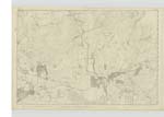
017 | [Situation] In the NW. [North West] of the Parish of Old Luce about 2 3/4 miles from Glenluce (in a direct line) & 3/4 mile NW [North West] of Gabsnout Bridge. A large hill situate by the side of the river Luce it is sometimes called Fell of the Craig by the country people on [the] Summit is a Trigl. [Trigonometrical] Station |
| CRAIG | Craig Craig Craig Craig |
William Cumming William T. Saunders James Gibson Esq. Ainslie's map 1782 |
017 | [Situation] In the NW. [North West] of the Parish of Old Luce near the west side of the river & 1/3 mile N.W. [North West] of Gabsnout Bridge. A farm yard consisting of well constructed houses with a [farm] attached in the occupation of Mr Wallace farmer Galdenach The property of Sir James D Hay Bart. [Baronet] |
| CARSCREUGH FELL | Carscreugh Fell Carscreugh Fell Cascrough Fell Cascreugh Fell Carscreugh Fell |
Thomas Wallace Peter Danil Peter Duglas Robert McKenzie George McHaffie Esqr. |
017 | [Situation] In the N [North] of the Parish of Old Luce & 1 1/4 miles north of Carscreugh Castle. A large hill rising regularly on all sides and consists of rough heathy pasture, on the Summit is a Trigl. [Trigonometrical] Station - See article "Soldier's Hill" |
Continued entries/extra info
[Page] 14Parish of Old Luce
Form 136 Page
15 - Craig Fell
15 - Craig
19 - Carscreugh Fell
Transcriber's notes
Name for Carscreugh Fell is probably on Plan 18 as it is on both .Transcribers who have contributed to this page.
Chr1smac -Moderator, JCB
Location information for this page.
Linked mapsheets.