OS1/35/32/78


| List of names as written | Various modes of spelling | Authorities for spelling | Situation | Description remarks |
|---|---|---|---|---|
| KNOCKBREX | Kockbrax Knockbrex |
Map of the property dated 1833 Mr Thomas McClymont Knockbrex |
013 | [Situation] About 2 miles W. [West] of N. [Newton] Stewart. a considerable Farm House and [out] houses built of stone and roofed [with] Slate. The Farm contains [about] [500] acres of tillage meadow and bog Property of Colonel S. Blair occupied by Mr Thomas [Mcclymont] |
| KNOCKBREX TOLL | Knockbrax Toll Knockbrex Toll |
Written on a board on the Toll house Mr Thomas McClymont Knockbrex |
013 | [Situation] About 2 miles W. [West] of N. [Newton] Stewart. Two Toll Gates at a junction of Roads on the road leading from Newton Stewart to [Portpatrick] |
| HIGH BARBUCHANY | High Barbuchany | Mr Dill Newtonstewart | 013 | [Situation] About 2 miles W. [West] of N. [Newton] Stewart. An ordinary Farm house and [out] houses and out houses and about 62 acres of good [Tillage] land. The property of the [Earl] of Galloway, occupied by Charles [Fulton] |
Continued entries/extra info
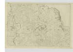
[Page] 78Trace No. 2. Plan 13 D
Names Corrected by Dennis [Kildoyle]
C.A. [Civilian Assistant] Apr [April] 15th
(Continued)
Transcribers who have contributed to this page.
Chr1smac -Moderator, JCB
Location information for this page.
Linked mapsheets.