OS1/35/32/25


| List of names as written | Various modes of spelling | Authorities for spelling | Situation | Description remarks |
|---|---|---|---|---|
| LANE BURN | Lane Burn Lane Burn |
Archibald Geddies H. McMuldroch |
013 | [Situation] In the Southern part of the parish and South of Brishy Bridge. A small stream rising in the Moss of Cree and falls into the River Cree at Brishy Bridge. |
| BRISHY BRIDGE | Brushy Bridge Brushy Bridge Brishy Bridge |
Archibald Geddies John Agnew George McHaffie Esq. |
013 | [Situation] In the S.E [South East] part of the parish and S by E [South by East] of Carty Port (New Quay). A small Stone Bridge on the low road from Newtonstewart to Wigton. This is a County Bridge. - |
| SHELL ACRE | Shell Acre Shell Acre or Store Ground |
Robert Stroyan George McHaffie Esqr. |
013 | [Situation] At Carty Port (Old Quay). An acre of Land allowed by the Earl of Galloway as a common chiefly for the use of Carty Port (Old Quay) |
Continued entries/extra info
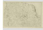
[Page] 25Parish of Penninghame
Form 136 Page
70; 71 Lane Burn
70 Brishy Bridge
69 Shell Acre
[Notes] "Lane" A brook, of which the motion is so slow as to be scarcely perceptible
"Burn" Water, particularly that which is taken from a fountain or well - a rivulet
(Scottish Dictionary)
Transcribers who have contributed to this page.
Chr1smac -Moderator, JCB
Location information for this page.
Linked mapsheets.