OS1/35/32/17


| List of names as written | Various modes of spelling | Authorities for spelling | Situation | Description remarks |
|---|---|---|---|---|
| RIVER CREE | Cree Cree Water River Cree River Cree |
Andrew McQueen Ainslies Map 1782 George McHaffie Esqr. John McMillan Esqr. |
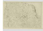
013 | [Situation] The Eastern Boundary of the Parish. A considerable River forming the eastern boundary of the Parish, also the Boundary between the Counties of Wigton & Kirkcudbright. The Tide flows to a point marked by the Makermore Ford. It is navigable for Vessels of about 50 Tons Burden to a Quay called Carty Port, above this the navigation of the River is rendered dangerous, if not altogether impeded from the course of the River through the loose sands composing its bed, being continually changing. |
| BARHILL WOOD | Barrhill Wood Barrhill Wood Barrhill Wood Barrhill Wood Barhill Wood |
Mr. Andrew McQueen Mr. J. McHarg Mr. J. Ray Mr. Robert Stroyan George McHaffie Esqr. |
013 | [Situation] 1 mile South of Newtonstewart and near the River Cree. An extensive wood embracing all the Plantations on Barrhill varying from 1 to 10 years growth. It is composed of both Fir and Forest Trees. - |
Continued entries/extra info
[Page] 17Parish of Penninghame
Form 136 Page
66 River Cree
48 Barhill Wood
Transcribers who have contributed to this page.
Chr1smac -Moderator, JCB
Location information for this page.
Linked mapsheets.