OS1/35/27/6


| List of names as written | Various modes of spelling | Authorities for spelling | Situation | Description remarks |
|---|---|---|---|---|
| DRUMPAIL BURN | Drumpail Burn Drumpail Burn Drumpail Burn Drumpail Burn . Gass Burn . . Drumpeal Burn Drumpail Burn |
Alexander McHarg James McCaa William Dalrymple Old Ordnance Map of Wigtownshire Map of Ld. [Lord] Bute's property 1792 Ainslie's map 1782 George McHaffie Esq. |
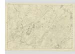
012 | [Situation] The South East boundary of the Parish. A Small River running in a North Easterly direction until it falls into the River Tarf [and] is the Boundary between the Parishes of New Luce & Old [Luce] |
| DRUMAWA | Drumawa Drumawa Drumawa |
John McHarg Alexander McHarg James McCaa |
012 | [Situation] 1/4 Mile north of Drumpail Burn. A Small Hill partially cultivated, situated [about] 1/2 mile south West of [the] Gass Farm House. |
| JORDAN BURN | Jordan Burn Jordan Burn Jordan Burn |
John McHarg James McCaa George McHaffie Esqr |
012 | [Situation] 1 Mile SW [South West] of Tarf Bridge. A Small Stream which rises in the moors of the Gass farm & runs into the Drumpail Burn. |
Continued entries/extra info
[Page] 6Parish of New Luce
Form 136 Page 29 - Drumpail Burn
30 - Drumwa
30 - Jordan Burn
Transcribers who have contributed to this page.
Chr1smac -Moderator, JCB
Location information for this page.
Linked mapsheets.