OS1/35/17/6


| List of names as written | Various modes of spelling | Authorities for spelling | Situation | Description remarks |
|---|---|---|---|---|
| THE SCAR | Loch Ryan Scar Loch Ryan Scar The Scar The Scar The Scar The Scar |
Robert McCamon James Robertson Adminalty Chart 1841 Ainslie's Map 1782 Rl. Engrs [Royal Engineers] Map 1819 George McHaffie Esqr. |
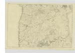
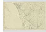
010 | [Situation] From 1 Mile to 1 1/2 Miles SE [South East] of Kirkcolm Village A high bank extending from [the] land a considerable distance into [Loch] Ryan it consists of accumulation of Sand & gravel apparently drifted together by the action of the tide it is remarKable for its large [oyster] bed producing oysters of a Superb quality which is generally sent to Glasgow and other [markets] Sir Alexander Wallace of Cairn Ryan [has] by Royal Charter an exclusive right [to] the oysters of this bank & of Loch Ryan in general He charges £20 per annum for the oyster of this sand bank. On [its] extreme point is a trig. [trigonometrical] Station. |
| KERRONRAE | Kerranrae Kerranrae Cairnroe Kerranrae Kerronrae |
Robert McCamon John McCrae Admiralty Chart 1841 William Black Esqr. Stranraer George McHaffie Esqr. Factor to the proprietor |
009 | [Situation] 10 Chains South of Kirkcolm Village A good farm house with out offices Slated and in good repair with a farm attached of 200 acres of good arable land. occupied by Robert McCamon The property of Sir A Agnew Bart [Baronet] of Lochnaw. |
Continued entries/extra info
[Page] 6Parish of Kirkcolm
Form 136
Page 34 - The Scar
33 - Kerranrae
Transcribers who have contributed to this page.
Chr1smac -Moderator, jennyb
Location information for this page.