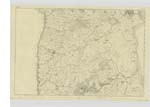
OS1/35/17/3


| List of names as written | Various modes of spelling | Authorities for spelling | Situation | Description remarks |
|---|---|---|---|---|
| MAHAAR | Maher Maher Mahaar Mahaar Mahaar Mahaar |
Robert Kerr John McHaffie William Black Esqr. Stranraer McNeil Caird Esqr. D. Guthrie Esqr. George McHaffie Esqr. |
009 | [Situation] 1/4 Mile West of Kirkcolm Church A Small farm house slated with outoffices in good repair with a farm of 50 acres of good arable land attached occupied by Robert Kerr |
| CLAYHILL PLANTATION | Clayhill Planting Clayhill Planting Clayhill Plantation Clayhill Plantation |
Thomas Watson John McHaffie See Name List Plan 5 A George McHaffie Esqr. |
009 | [Situation] 1/3 Mile West of Kirkcolm Village A long narrow Strip of Planting on the lands of Corswall consisting Fir & Ash. |
| BOAT BANK COT | Boat Bank Cot Boat Bank Cot |
David Guthrie Esqr. Admiralty Chart of Loch Ryan 1839 |
009 | [Situation] 1/2 Mile N by E [North by East] of Kirkcolm village A Small Cottage and garden in Corsewall Shore, the property of James Moor Esqr -Corsewall House Kirkcolm |
| CLENDRY HILL | Clandrey Hill Clandrey Hill Clanery Clannery Clannery Clendry Hill |
James Robertson Robert [McCanion] Ainslie's Map 1782 Rl. Engrs. [Royal Engineers] Map 1819 Admiralty Chart of Loch Ryan 1839 George McHaffie Esqr. |
009 | [Situation] 3/4 Mile South of Kirkcolm Village A large hill near the South Side of Kirkcolm village on which is a trig [trigonometrical] Station called "Clendrie" The Soil is arable Situate on the farms of Clendrie & Martlaugh |
Continued entries/extra info
[Page] 3Plan 10A -- [on Map 009]
Parish of Kirkcolm
Form 136
Page 31 - Mahaar
32 - Clayhill Planting
Boat Bank Cot
31/44 - Clandrey Hill
[Note] See the Name Clendry in page 5.
Transcribers who have contributed to this page.
Chr1smac -Moderator, jennyb
Location information for this page.
Linked mapsheets.