OS1/35/17/27


| List of names as written | Various modes of spelling | Authorities for spelling | Situation | Description remarks |
|---|---|---|---|---|
| DEIL'S DIKE | Deils Dike Deils Dike Deils Dike Devil's Dyke Deil's Dike |
John Crindle John McCreadie Statistical Acct [Account] 1839 Page 232 Chalmer's Caledonia Vol. [Volume] 3 P. [Page] 237 George McHaffie Esqr. |
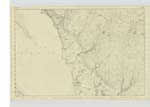
010 | [Situation] 1/2 mile North and North West of Craigcaffie Fell. An ancient rampart the track or remains of which Can now with difficulty be traced It consisted of a Strong dyke or wall eight feet broad and extended through Galloway a distance of about 53 miles commencing at Loch Ryan in the farm of Beoch and ending at Solway Firth nearly opposite Bowness in Cumberland where the great wall of Adrian Commenced It was in some places built of stone in other places of stone & clay etc At some parts of its course it is Called the "Roman Dyke" & in Kells parish in Kirkcudbright it is called the "Auld Head Dyke of Scotland" there is no authentic record extant to show by what people it was constructed or what purpose. There was a dyke or rampart Similar to this in the East of England which is called in like manner the Devils Dyke & was in the middle ages called Rech Dyke or Giants Dyke - see Camdens Brittanica also Palgreaves History of the Anglo Saxons Page 42 the latter dyke was built in the time of the Saxon Kingdoms by the East Anglians it runs thro [through] part of Suffolk - For further description of the Deil's Dyke See Chalmer's Caledonia Vol [Volume] 3 Page 237 also Statistical acct. [account] of Scot. [Scotland] 1839 V [Volume] 21 Page 232 |
Continued entries/extra info
[Page] 27Parish of Inch
Transcribers who have contributed to this page.
JCB, Chr1smac -Moderator
Location information for this page.
Linked mapsheets.