OS1/35/17/11


| List of names as written | Various modes of spelling | Authorities for spelling | Situation | Description remarks |
|---|---|---|---|---|
| ST MARY'S CROFT | St. Mary's Croft St. Mary's Croft St. Mary's Croft Croft McMechan Croft McMechan St. Mary's Croft Mackmakin |
David Gibson Esqr. James McMeikan James Robertson Admiralty Chart 1841 Rl. Engrs. [Royal Engineers] map 1819 George McHaffie Esqr. Ainslie's Map 1782 |
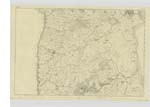
009 | [Situation] 1 3/4 Miles South by East of Kirkcolm Village A farm house and outhouses Slated and in good repair & a Small tract of land of about 5 acres occupied by the proprietor James McMeikan This Small freehold was given as free gift by Sir Stair Agnew of Lochnaw to an Ancestor of the present proprietor James McMeikan On near this ground tradition Says was an ancient Chapel but this site of it Cannot now be traced Has been in possession of a Race of McMeikans for Several Centuries - See Symson's Galloway app. [appendix] to History of Galloway |
| KILMORIE CHAPEL | [Supposed Site] | See Statistical Acct. [Account] 1841 page 111 See Chalmer's Caledonia Vol [Volume] 3. page 443 |
009 | In Symson's description of Galloway written in 1684. See Appx. [Appendix] Hist. [History] Galloway Vol [Volume] 3 p [page] 84 it is stated. In this parish also about a mile & half from the Kirk, in the way bewtwixt it and Stranraer, there was of old a Chapel called Killemoris, but now wholly ruinous, within a little croft, -- possessed by a Countryman, John McMechan -- he and his predecessours having enjoyed the same for several generations, etc. etc. |
| THE WIG | The Wig The Wg the Wig The Wig The Wig |
William McDowal Admiralty Chart 1841 Chalmers Caledonia Vol [Volume] 3 Page 350 Ainslie's map 1782 George McHaffie Esqr. |
009 | [Situation] 1 Mile S E [South East] of Kirkcolm Village A Considerable Creek or bay formed by the ridge of the Scar on the west Side of Loch Ryan where coasting vessels & coal boats &c. Sometimes anchor it is naturally a handsome Small bay but Shallow therefore large vessels cannot anchor in it |
| WIG SANDS | Wig Sands Wig Sands Wig Sands Wig Sands |
William McDowal Robert Campbell Admiralty Chart 1841 George McHaffie Esqr. |
009 | [Situation] 3/4 Mile S E [South East] of Kirkcolm Village A tract of Sand along the northern shore of The Wig |
Continued entries/extra info
[Page] 11Parish of Kirkcolm
Form 136
Page [32] - St. Mary's Croft
[34] - The Wig
33 - Wig Sands
Transcriber's notes
[on Map 009]Transcribers who have contributed to this page.
Chr1smac -Moderator, jennyb
Location information for this page.
Linked mapsheets.