OS1/35/16/9


| List of names as written | Various modes of spelling | Authorities for spelling | Situation | Description remarks |
|---|---|---|---|---|
| GALDENOCH BURN | Galdenoch Burn Galdenoch Burn Goldenoch Burn Galdenoch Burn |
William Cambell James Hegan Rl Eng [Royal Engineers] Map 1819 List of Names taken from Proprietors Returns supplied by G.McHaffie Esqr. |
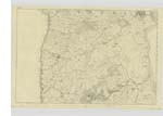
009 | [Situation] From 1 mile to 2 miles West by North of Lochnaw Castle A Burn or Stream which is the union of Mill Isle Burn and Green Burn meeting near Galdenoch Mill and Supplying or forming a Mill pond, at the above place after running from this pond it takes the name Galdenoch Burn and running a short distance in a westerly direction - runs into the sea south of SlocKnawen |
| CRAIGINCORE | Craigincore Craigincore Craigincore |
Alexander Cochrane James McEwen George McHaffie Esqr. |
009 | [Situation] Nearly two miles W N W [West North West] of Lochnaw Castle. A small Hillock the under soil of which is Rocky Slightly covered with arable soil situate on the W. [West] side of Torindoos Hill on the Farm of High Mark |
| TORINDOOS HILL | Torindoos Hill Torindoos Hill Torindoos Hill |
James McEwen Alexander Cochrane George McHaffie Esq. |
009 | [Situation] 1 3/4 miles W. N. W. [West North West] of Lochnaw Castle A small Hill or portion of slightly elevated ground on the Farm of High Mark, at the South East side runs the Galdenoch Burn |
Continued entries/extra info
[Page] 9 -- Parish of LeswaltCraigan a Small Rocky hillock
Torran - a hillock or little hill } The Bushy hiilock
Dosach - Bushy
or
Toran Dubh -- The Black hillock
Transcribers who have contributed to this page.
Chr1smac -Moderator, eileenmcnaught
Location information for this page.
Linked mapsheets.