OS1/35/3/6


| List of names as written | Various modes of spelling | Authorities for spelling | Situation | Description remarks |
|---|---|---|---|---|
| PORTBEG | Portback Bay Port Beck Portbeck Portbeg Portbeg Portbeg |
Commander C.G. Robinsons Chart of Loch Ryan Rl. N. [Royal Navy] 1839 Ainslie's Map 1782 Rl. Engrs. [Royal Engineers] Map 1819 John McDowal John McCrea Senr [Senior] George McHaffie Esqr. |
004 | [Situation] ¾ Miles N. by E. [North by East] of Kirkcolm Village & 1¼ Miles North of Corsewall A small Port or Harbour for fishing boats, a place where boats take in Cargoes of the Neighbours produce to export to the larger Vessels lying in Loch Ryan, It is the property of James Moore Esqr. Corsewall House Kirkcolm, |
| HIGH CLACHAN | High Clachan Clachan High Clachan High Clachan High Clachan |
David Guthrie Factor Ainslie's Map 1782 David Agnew David Stalker George McHaffie Esqr. |
004 | [Situation] In the N.E [North East] portion of the Parish ½ mile NW [North West] of Corsewall A large portion of cultivated Country bordering on [the] West Shore of Loch Ryan It consists of seven or eight Farms or divisions The larger portion of which Consists of 115 Acres of land a good dwellinghouse and offices in good repair. and the Smaller portions [vary] in Size from 115 to 1 Acre High Clachan is the property of James Moore Esqr. |
Continued entries/extra info
[Page] 6Parish of Kirkcolm
Form 136
Page 63 & 81 - Portbeg Bay
60 & 82 - High Clachan
Transcribers who have contributed to this page.
Chr1smac -Moderator, NRS - Moderator, Missus SW
Location information for this page.
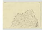
Linked mapsheets.