OS1/34/69/4


| List of names as written | Various modes of spelling | Authorities for spelling | Situation | Description remarks |
|---|---|---|---|---|
| Site of GRIME'S DYKE or ANTONINUS'S WALL | Wall of Antoninus Pius Roman Wall - Called Grime's Dyke. Grime's Dyke or Wall of Antoninus Pius |
Stewart's Caledonia Romana Genl General Roy's map of the Wall Chalmers Caledonia |
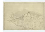
001 | part of the Fort was dug up at the letter i, within the last 5 or 6 years. On the West Side, and close to the Outbuildings belonging to Carriden House, runs a Burn through a deep Ravine, extending to the Sea:- by referring to the Plan, it will be seen that the supposed site of the Roman Road is shewn as running to the South of the Outbuilding presuming that the Road would seem in that direction to avoid the Ravine; this of course is only supposition, for it is just as likely to have been made straight from the Fort to Drum, as for it to maKe a detour; but the appearance of the ground favors the supposition of its running South of the Houses. In inserting the Site of the Wall and Road, where no Traces were found to guide me, I have been mostly guided by the opinions of the following Gentlemen & Farmers &c. all of whom I called upon and saw personally. William Walker Esq. of Inveravon; Dr. Walker, a gentleman who lived many years at Inveravon with the late Mr Thompson, and who is at present living with Mr. Walker;- Alexander KirKwood, Farmer, Hainnings:- Robert Learmonth. Farmer Nether Kinneil. William Luck, Gardener to Captain Wilson of the Dean, Revd Mr. McKenzie Minister Established Church Borrowstounness. Henry Cadell Esq. Grange House. Revd Mr. Fleming. Minister, Established Church Carriden, James Cruickshanks, Burnfoot;- William Davidson, Carriden House. Mr.McKinlay, Bonnington; by Leith, who resided many years near Bo'ness as Collector of Customs.- I have been influenced also by the situation and general appearance of the ground:- as it has been observed throughout the whole course of the Wall of Antoninus Pius, from KirKpatrick to Carriden, to have been constructed on the Northern Slopes of the Hills or Declivities that commanded a view to the North, from which the enemy would make the attack, and besides, rendered the construction of the ditch and Rampart easier. The Forts were also built with a view to system as appears from General Roy's observations, see Roy's Military Antiquities page 154. |
Continued entries/extra info
[Page] 4[continued from previous page]
[signed] C.N. Martin Capt. R.E. [Captain Royal Engineers]
[signed] Robert J. Winkup 2nd Cor. R E. [Corporal Royal Engineers]
3rd. May 1859
Transcribers who have contributed to this page.
Bizzy- Moderator, alamer
Location information for this page.
Linked mapsheets.