OS1/33/20/288


| List of names as written | Various modes of spelling | Authorities for spelling | Situation | Description remarks |
|---|---|---|---|---|
| ALLT LÒN A' CHÙIL | Allt Loin-a-Caol | Mr. Hugh McKay, Dalharrold. Mr. Thomas McKay, Inslampie. |
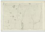
045 | A rivulet about 5 miles in length, rises near Loch Feusag, flows South, joins Rimsdale Burn near Loch Rimsdale. Sig. [Signification] - (Corrupt) |
| ALLT LÒN A' CHAOIL 1-inch Revision Oct. 1894. | Allt Lòn a' Chaoil Allt Lòn a' Chaoil Allt Lòn a' Chaoil |
Mr. William Matheson Easter Badenloch Mr. James McKay fm. [farmer] Bunahoun (Strath Halladale) formerly Badenloch Mr. Donald McKay shd. [shepherd] Garvault |
[Signification] Burn of the marsh of the narrow | |
| LOCH NA CRÌCHE | Loch na Crioche | Mr. Hugh McKay, Dalharrold. Mr. Thomas McKay, Inslampie. |
045 | A small Circular Loch, on the East Side of "Lon-a-Coal Burn", where the Ph. [Parish] Boundary leaves the Stream Sig: [Signification] "Loch of the Boundary" |
| CNOC BOTHAN UISGE-BEATHA | Cnoc Bothan Uisge-Beathe Craig na Ruivaig |
Mr. Hugh Mckay, Dalharrold Mr. Thomas Mckay, Inslampie Estate Map |
045 | The top of a ridge or water shed extending from "Cregan Dhubh Reidhe Bhig" to Lon-a-Coal Burn. Being part of the Boundary between Ph. [Parish] of Farr & Kildonan. Sig: [Signification] "Whisky Bothy Hill" |
Continued entries/extra info
[Page] 288Parishes of Kildonan & Farr -- Co: [County] of Sutherland
Transcribers who have contributed to this page.
KBMW- Moderator, Invicta2
Location information for this page.
Linked mapsheets.