OS1/33/9/108


| List of names as written | Various modes of spelling | Authorities for spelling | Situation | Description remarks |
|---|---|---|---|---|
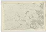
| CREAG ASTAIL | Creag Astaile Creag Astaile Creag Asdale Creag Asdale Creag Asdale |
Mr George Munro, Astle Rev [Reverend] Mr. Joass Golspie Duke of Sutherland's Maps 1833 & 1852 Map published by Black Valuation Roll of the County 1877 - 8 |
109 | Applies to a good Sized hill Situated adjacent to and W [West] of "The CrasK" it is not very prominent and is Covered with Heather the name Signifies "Hill of the Building" Vide amended description page 109. |
| CRAIG ASTEL 1-inch Revision Oct 1894 | Craig Astel | For authorities &c. see page 109 | 109 | |
| THE CRASK | The Crask The Crask The Crask |
Mr George Munro Rev [Reverend] Mr. Joass William S. Fraser Esqr. Dornoch |
109 | Applies to an Elongated Hill or Ridge Situated about a 1/4 of a mile South of the dwelling house of "RhistocKach" it is covered with Heather. name Anglicised. |
| ALLT REIDH A' BHÀTHAICH | Allt Reidh a' Bhàthaich Allt Reidh a' Bhàthaich |
Mr George Munro Rev [Reverend] J.M. Joass |
109 | This stream has its Source a Short distance north of the Western Extremity of "Clashmore Wood" flows in am Eastern direction and Enters the "River Evelix" in the district of "Astle" Signification "The Smooth Burn of the Byre" |
Continued entries/extra info
[Page] 108Sutherland -- Ph. [Parish] of Dornoch
Creag Astaile [Note]
altered from
Creag Astaile to Creag Asdale
Creag Astaile and Creag Asdale [Crossed out]
Transcribers who have contributed to this page.
KBMW- Moderator, Bizzy- Moderator
Location information for this page.
Linked mapsheets.