OS1/31/20/77


| List of names as written | Various modes of spelling | Authorities for spelling | Situation | Description remarks |
|---|---|---|---|---|
| Isle of West Burrafirth | Isle of West Burrafirth Isle of West Burrafirth Isle of West Burrafirth Burrafirth Holm Holms of Burrafirth |
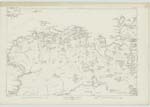
Andrew I. Grierson Esqr. of Quendale Mr. Robert Jamieson, Teacher, Sandness Mr. Christopher Dowl, West Burrafirth Johnston's Map Admiralty Chart | 041 | A rocky island about 36 acres in extent, situated in the sea, about 1/2 mile north of the hamlet of "West Burrafirth" and immediately north of "The Heag.". It is in the Parish of Aithsting and are the property of Andrew I. Grierson Esqr. of Quendale. |
| Tainga Skerries | Tainga Skerries Tainga Skerries Tainga Skerries |
Andrew I. Grierson Esqr. of Quendale Mr. Robert Jamieson, Teacher, Sandness Mr. Christopher Dowl, West Burrafirth |
041.03 | A group of High Water Mark rocks situated in the sea midway between "Isle of West Burrafirth and "Tural Stack." They are in the Parish of Aithsting and are the property of Andrew I. Grierson Esqr. of Quendale |
| Turl Stack | Tural Stack Tural Stack Tural Stack Turl Stack Turril Stack Tiril Stack |
Andrew I. Grierson Esqr. of Quendale Mr. Robert Jamieson, Teacher, Sandness Mr. Christopher Dowl, West Burrafirth Peter Irvine & another West burrafirth |
041.03 | A large High Water Mark rock situate in the sea, nearly a 1/4 of a mile east of "Tings Skerries" and nearly 1/2 mile north of "Whaalwick." It is in the Parish of Aithsting and are the property of Andrew I. Grierson Esqr. of Quendale. |
Continued entries/extra info
[Page] 77Parish of Aithsting, -- Shetland
[Signed] Alexander Fraser C/A [Civilian Assistant]
Transcribers who have contributed to this page.
hastingleigh, Trondragirl- Moderator
Location information for this page.
Linked mapsheets.