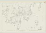
OS1/31/2/159
| List of names as written | Various modes of spelling | Authorities for spelling | Situation | Description remarks |
|---|---|---|---|---|
| Kirk Holm | Kirk-Holm Kirk-Holm Kirk-Holm Kirk-Holm Kirk-Holm Kirk-holm |
A. Umphray Esqr. of Reawick Revd [Reverend] William Rose, Parish Minister New Statistical Account of Scotland Johnston's Map. Admiralty Chart. Orkney and Shetland Guide, 1878 |
051 | A small rocky island situated at the mouth of "Seli Voe" and, a short distance south of "Kirka Ness." The property of J. Leask Esqr. of Sand. "The small island called Kirkholm in the mouth of Seli Voe presents every appearance of having at one time been put in a state of defence. And the foundation of nine houses, for the accommodation of those who may have fortified themselves in it can still be traced. |
| Ruins | A Spanish ship was wrecked near here at the time of the Spanish Armada in 1588, and the Crew established themselves on this Island for a time; These remains are no doubt those of the buildings they erected (Intd) [Initialled] J. C. M. |
Continued entries/extra info
[Page] 159parish of Sandsting -- Shetland
[signed] A. McDonald 2nd. Corpl R.E. [Corporal Royal Engineers]
Transcriber's notes
Situation changed to 051 as Map 051.03 unavailable.Transcribers who have contributed to this page.
Trondragirl- Moderator, pungo
Location information for this page.
Linked mapsheets.


