OS1/30/7/108


| List of names as written | Various modes of spelling | Authorities for spelling | Situation | Description remarks |
|---|---|---|---|---|
| Hurkle Rig | Hurkle Rig Hurkle Rig Hurkle Rig |
Mr Robert Brydon E [East] Redfordgreen John Aitken W [West] Redfordgreen John Potts Shiringscleuch |
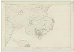
019 | A considerable ridge of Moorland Situated on the farm of East Redfordgreen. The origin of this Name is not Known. |
| Wilson Burn | Wilson Burn Wilson Burn Wilson Burn |
Robert Brydon John Aitken John Potts |
019 | A considerable Stream flowing from Hellmoor Loch in a W S [West South] Easterly Course and forming a portion of the boundary betwixt the Parishes of Kirkhope and Roberton |
| West Redfordgreen | West Redfordgreen West Redfordgreen West Redfordgreen |
John Aitken Tenant Robert Brydon John Potts |
019 | A good stone building one story high with out-houses, garden, arable and pasture farm attached. Proprietor His Grace the Duke of Buccleuch. |
Continued entries/extra info
[Page] 108Parish of Kirkhope
Sheet 19
Described by John Callanan Lce Corp RE [Lance Corporal Royal Engineers]
Transcribers who have contributed to this page.
Skinnb1- Moderator
Location information for this page.
Linked mapsheets.