OS1/30/7/1


| List of names as written | Various modes of spelling | Authorities for spelling | Situation | Description remarks |
|---|---|---|---|---|
| Kirkhope | Parish of Kirkhope Parish of Kirkhope |
Revd. [Reverend] John S. Gibson, Ettrickbridge End Mr. Hugh McMoran, Schoolmaster Abridged Statistical History of Scotland Vol 2 Pages 991 & 992 |
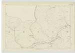
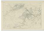
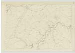
010 ; 011 ; 014 | A hilly parish, chiefly Moorland, bounded on the North-East by the Parish of Selkirk, on the East by Roxburgh Shire, on the South by Selkirk-Detached, and Roberton, on the West by Ettrick, and on the North-West by Yarrow, Its greatest length is about 9 miles, and average breadth 6, containing an area of about 50 Square Miles. Ettrickbridge End is the only Village, Situated in the Northern district of the Parish, 7 Miles from the town of Selkirk, and about 5 from Yarrow. The parish Church, School and Manse are Situated at Ettrickbridge End, the former Erected in 1838 - at an Expense of £800. and the two latter in 1834, and 1852, respectively. In connection with the School in Ettrickbridge End, are two others, one at Gilmanscleuch, and the other at Redford Green. Ettrick Water intersects the Parish from West to North-East. Shaws Hill and Gilmanscleuch Law are considered to be the loftiest Elevations in the parish. Population (of the parish) about 600. Ministers Stipend £208.6.8. There is no Burial ground in the parish of Kirkhope, the grave-yard at Yarrow serves for both parishes at present. It is traditionally assigned that a Church or Chapel formerly stood near Kirkhope, not a vestige of which now remains to indicate its site. Previous to June 1851, the parish of Kirkhope formed part of the Parish of Yarrow, at which period, |
Continued entries/extra info
[Page] 1Parish of Kirkhope
Sheets 10.11.14.15.18 & 19
Described by John Callanan
Lce [Lance] Corpl[Corporal] R E [Royal Engineers]
Transcribers who have contributed to this page.
Skinnb1- Moderator, AMRM
Location information for this page.