OS1/30/3/68


| List of names as written | Various modes of spelling | Authorities for spelling | Situation | Description remarks |
|---|---|---|---|---|
| Falagrain Middle | Falla Grain Middle Falla Grain Middle Falla Grain Middle Fala Grain Middle Fala Grain Middle |
Mr_ D_ Anderson, Cossarhill_ Mr_R_ Brydone, Shepherd_ Cossarhill_ Mr_ T_ Clendenning, Brockhoperig_ Walter Copeland Esq. Factor Thirlestane Castle County Map_ |
017 | A high hill covered with rough pastrure on Cossarhill farm, between the head of Bla[ck] Grain and Falla Grain. |
| Trow Grain | Trow Grain Trow Grain Trow Grain Trow Grain |
Mr_ D_ Anderson, Cossarhill_ Mr_R_ Brydone, Shepherd_ Cossarhill_ Mr_ T_ Clendenning, Brockhoperig_ W Copeland Esq. Factor Thirlstane |
017 | Trow Grain is a small stream rising on the South Side of Trow Ggrain Middle' and unites with Fall[a] Grain in forming the source of Back [Burn] |
| Fala Grain | Falla Grain Falla Grain Falla Grain Fala Grain Fala Grain |
Mr_ D_ Anderson, Cossarhill_ Mr_R_ Brydone, Shepherd_ Cossarhill_ Mr_ T_ Clendenning, Brockhoperig_ Walter Copeland Esq. County Map |
017 | Falla Grain - A Stream, rises on the South Side of the "Middle"_ of the [same] Names, and unites with Trow [Grain] |
| Back Burn | Back Burn Back Burn Back Burn |
Mr_ D_ Anderson, Cossarhill_ Mr_R_ Brydone, Shepherd_ Cossarhill_ Mr_ T_ Clendenning, Brockhoperig_ Walter Copeland Esq Factor Thirlestane Castle County Map |
017 | Back Burn - so called from the conf[luence] of the two Grains" at its head - to [which] it Joins the Ettrick, at Brockhoperig |
Continued entries/extra info
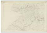
[Page] 68Ettrick Ph. [Parish] -- Sheet 17. -- Trace 5_
Transcribers who have contributed to this page.
Chr1smac -Moderator, John Dunlop
Location information for this page.
Linked mapsheets.