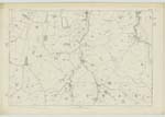
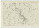
OS1/29/31/1
| List of names as written | Various modes of spelling | Authorities for spelling | Situation | Description remarks |
|---|---|---|---|---|
| OXNAM [parish] | Oxnam | New Statistical Acct. [Account] of Roxburgh Valuation Book for Roxburgh, 1811. Blackwood's Map of Roxburghshire. |
022; 027; 028; 034; 035 | [Situation] In the En. [Eastern] division of Roxburghshire. The name of this Parish is an abbreviation of Oxenham, a mode of spelling which appears by ancient Charters to have been adopted for several centuries and indicates the origin of the name, - the district acquiring its distinctive appellation from its abounding with oxen and partly because it afforded protection to numerous herds of Cattle during the feudal period. The Parish of Oxnam is bounded on the North by that of Jedburgh, on the East by Hownam, on the South by Northumberlandshire and on the West by the Southern division of Jedburgh and Southdean. There is no part of another Parish situate within the limits here assigned to it nor is there any part of it detached. Its shape is that of an irregular oblong stretching N.N.W. [North North West] but running into a point on the North. It measures 10 miles in extreme length and about 5 miles in extreme breadth and it Contains an Area of about 21,223 Impl. [Imperial] Acres, of which, about 3480 are Arable, 653 Wood and 16990 Pasture &c. The greatest elevations are the Cheviot Hills on the southern boundary which attain a height there of about 2000 feet and from which numerous dome-like hills smooth and green and gracefully curved in their outlines recede far into the interior [Continued on page 2] |
Continued entries/extra info
[Page] 1Parish of Oxnam -- County of Roxburgh.
Transcribers who have contributed to this page.
Trondragirl- Moderator, Douglas Montgomery
Location information for this page.
Linked mapsheets.


