OS1/29/27/1


| List of names as written | Various modes of spelling | Authorities for spelling | Situation | Description remarks |
|---|---|---|---|---|
| MAXTON [parish] | Maxton (Parish] | The County Map New Statistical account Fullarton's Gazetteer |
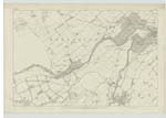
008.12; 008.15; 008.16; 009.09; 009.10; 009.13; 009;04; 014.03; 014.04; 014.08; 015.01 | Maccus was a person of some note in the reign of David I. betwixt the years 1116 and 1147. His Tȗn or Manor was called "Maccus-ton," afterwards MacKiston & now Maxton. The Parish of Maxton is in figure nearly an oblong. Its extreme length is about 4 miles, and its greatest breadth nearly 2 1/2 miles but its square Contents do not come up to 7 miles, the actual area being 4494 acres. Maxton lies on the South banK of the Tweed, & is one gentle Slope towards that river, which runs nearly 4 1/2 miles along its northern boundary. It is bounded on the North by MaKerston in Roxburghshire; and Maxton in Berwickshire; on the west by St. Boswells; South West by Ancrum; and on the S.E. [South East] and East by Roxburgh When Scotland was a separate Kingdom, the village of Maxton seems to have contained a very considerable [Continued on page 2] |
Continued entries/extra info
[Page] 1Parish of Maxton
[Signed] W Beatty
Transcribers who have contributed to this page.
Trondragirl- Moderator, Chr1smac -Moderator, Bizzy- Moderator
Location information for this page.
Linked mapsheets.