OS1/29/18/87


| List of names as written | Various modes of spelling | Authorities for spelling | Situation | Description remarks |
|---|---|---|---|---|
| WATLING STREET | Roman Road Roman Road Roman Road Roman Causeway Roman Road Watling Street (Roman Road) Watling Street (Roman Road) Watling Street (Roman Road) Watling Street (Roman Road) |
James James Esqr. Samieston John Johnstone Crailinghall John Mitchell Cunglebank School Stobie's County Map 1770 Origines Parochiales Jeffrey's History of Roxburghshire Rev: [Reverend] Dr. [Doctor] Aitken Minto Manse Rev: [Reverend] J. Duncan Denholm G. Rutherford Esqr. Jedburgh W. Dean Esqr. Suna Cottage |
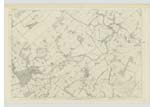
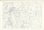
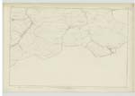
015; 021 | The most important remain in this district of the Roman people, is the great Military way, called the "Watling Street". Its name is derived from the Saxon Wathol, a road or way. It starts from the Praetorium in Yorkshire, and on its way north crosses the Tees River at Pierse bridge, where there are the remains of a Station on the north bank of the River. It then proceeds by Binchester, & Lanchester, and Ebchester, at which place it leaves the County of Durham, and enters the County of Northumberland. It then stretches away to Corbridge, where it passes the River Tine. From Corbridge the Road proceeds onwards to the wall which runs between Solway & the Tine, & passes it a little to the westward of Hunnum. From this place the Road runs northward, to the East of Cocklaw, Swineburns, and Chipchase Castles, to Risingham Station. After leaving Risingham, the Road takes a northwest direction for about eight miles, when it arrives at Rochester, the Bremenium of the Romans, occupying a pass in the Cheviot range of mountains. After the road leaves Rochester it bends straight north, and makes for the border line at the head of Coquet, passing Holehouse, crossing Thirlmoor, and by Gammel's Path, reaches "Chewgreen", the Ad Fines of the Itinerary. On the West edge of the road as it runs from Redesdale to Chewgreen, there are Stones at regular distances, called "Golden Posts". General Roy thinks that these stones were erected by the Romans, for the single purpose of marking the distances on this highway. On leaving Chewgreen the road bends to the east, round the mountain Called Brownhartlaw, and while doing so, it crosses the border line, and from thence proceeds northward on the back of the range of hills which send down their streams into the Cayle, near the Hindhopes, on the West of Blackhallhill and Resby-fell; thence by the head of Skerrysburghope, and onwards to Wodenlaw, the eastern base of which it skirts, and descends the mountains to the Cayle, which it passes at Towford. On fording the Cayle the road ascends the north bank, and in about three quarters of a mile reaches a place called Street House, distant about six miles from Chewgreen, where Agricola encamped. From this Camp, the road in its way northward passes Middlesknows, Smailcleuch, Swinelaw, and Upper Chatto. It then winds round Cunzierton hill, on the summit of which is a strongly entrenched British Fort, and thence by the Batts, Hardenhead, Rannesfen, to Capehope where it passes the Oxnam Water. After fording this stream it ascends the high ground between the Oxnam & the Jed, a little to the east of Jedburgh, the northern slope of which it descends to the River Jed, which it Crossed to the next station at Bonjedworth. Between Chewgreen & Bonjedworth the road is open, and often used by the farmers and inhabitants of the district. Extracts from Jeffrey's History of Roxburghshire Vol. [Volume] 1 Pages 213 to 223. |
Continued entries/extra info
[Page] 87Parish of Jedburgh
Plan 21. 8. Trace No. 1
Owen Barrett
Thomas Watson 2nd. Corp: R.E. [Corporal Royal Engineers]
Transcribers who have contributed to this page.
Skinnb1- Moderator, ElaineF
Location information for this page.