OS1/29/9/50


| List of names as written | Various modes of spelling | Authorities for spelling | Situation | Description remarks |
|---|---|---|---|---|
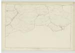
| ROMAN ROAD [Crailing parish] | Watling Street ROMAN ROAD (Via Militaris Antoninus Iter 5th) |
Chalmers Caledonia Jeffrey's History Roxburghshire {map published by the Society for Promoting Useful Knowledge}. Itinera of Richard of Cirencester Antonini Iter Britanniarum | 015; 021 | A portion of one of the great Roman Military Roads, called by the Saxons, the "Watling Street"; from the Saxon Wathol, a road or way. It starts from the "Praetorium" in Yorkshire, and on its way north crosses the River Tees at Pierse Bridge, where there are the remains of a station on the North bank of the River. It then proceeds by Binchester, Lanchester, and Ebchester, at which place it leaves the county of Durham, and enters the County of Northumberland. It then stretches away to Corbridge, where it passes the River Tyne; the foundations of this Bridge still exist. From Corbridge it proceeds onwards to the wall which runs between Solway & the Tyne, and |
Continued entries/extra info
[Page] 50Crailing Parish W. Beatty c. a. [civilian assistant].
Cause of erasing the above note [Via Militaris Antoninus Iter 5th] from the Plans. See page 27 of Name Book for Parish of Ancrum
Transcriber's notes
OS1/29/1/27 (Ancrum) has the following note:This note viz. via militaris Antoninus Iter 5th is not correct. This road is not the 5th Iter of Antoninus. See Correspondence relating to this dated January 14th 1865 by Mr Hall and January 17th 1865 by Captain Carey R.E. [Royal Engineers] and Colonel Cameron's Decision 10/2-1865.
The Note - now erased from the 1/2500 Scale Plans and from the 6 inch scale photographs.
J Carpenter
Examn: [Examiners] Office Southampton
March 1865
Transcribers who have contributed to this page.
Skinnb1- Moderator, raschdorff
Location information for this page.